8/12/15

Introduction

     The adventure continues!  It happened the week of August 1 thru 8, 2015, thus time up in the Pacific Northwest.  Destination:  the San Juan Islands, an archipelago located in Puget Sound, that extensive body of ocean which cuts deeply into the northwest corner of Washington State.  The islands are surrounded by snowcapped mountains on three sides and covered with lush vegetation.  The scenery is as wild and majestic as can be.
The San Juan Islands

     This would be our third bareboat sailing charter.  The 1st one was in 2011, when we journeyed to the British Virgin Islands, in the Caribbean.  Here is the link:  http://www.viyachts.com/bareboat-trip-reviews/bvi-yacht-charters-woods.php
      The 2nd one took place in 2013, destination Florida Keys.  The link is: http://woodsonrainbowsend.blogspot.com/
      But this bareboat charter will break some new ground, in several ways:  First off, it will be in COLD WATER.  No swimming!  A man overboard situation could be life-threatening.  (Well, we broke this rule a few times - details to follow.)
      Secondly, my brother Tim will not be there.  Tim has been my rock-steady "mighty sailing man" First Mate and Maneuvering Under Power Expert for our previous trips.  In comparison, my crew this time around is rather young and inexperienced.  (Side note:  I don't want a skipper who is "brave".  I prefer one with a healthy respect for Mother Nature.  And that would be me.)
      Thirdly, we will be aboard a monohull.  We actually prefer catamarans, but it seems they are not very numerous up here.  Anacortes Yacht Charters, who we booked thru, did not have any available at all.  (I'll have more to say on possible reasons for this later.)  So, this trip would actually be my very first foray as skipper of a yacht-sized monohull.  Get ready for life at a 45⁰ angle!
      So why did we choose the San Juan Islands (SJI's), to sail in icy cold water, on a monohull?  Well, a big factor is the cost just to GET to where you want to sail.  It takes big bucks to get to remote Caribbean Islands, but it's relatively cheap to fly to big domestic cities like Seattle.  Also, Joan and I lived up here, in Tacoma, from 1979 to 1983, and Joan has been itching to come back ever since.  And you can't blame her!

      And so my seven-person crew came together.  We were a diverse lot, hailing from all over the US.  Joan and I, of course, live in Houston.  Joining us was my nephew Mitch (Tim's son) who presently lives in Baton Rouge.  Then there was our good friends Robert and Michelle, currently from Boston.  Daughter Emily is in San Francisco.  Rounding out the crew was Emily's friend Caroline, from Atlanta.
The crew at Buck Bay:  Emily, me, Joan, Robert, Michelle, Caroline (Mitch is the cameraman).

Sat, Day #0. Anacortes

         This would turn out to be one very, very long day.  It started with a 6:00 a.m. flight out of Houston, with a layover in Phoenix.   In order to avoid potential hassles with checked bags, I shipped a package of stuff to myself care of Anacortes Yacht Charters a couple of weeks ago.  That worked well!  All flights were on time, and nobody missed their flight.
       As our flight descended into SeaTac, we could clearly see all of the major peaks of the Cascades, including Mt. Shasta (in California), Hood (in Oregon), Adams, St. Helens, Rainier, and several major rivers.  (Side note:  St. Helens erupted when we lived here, back in 1980.) Actually, Joan was the one rattling off all these geographic landmarks.  She impressed me greatly with her 30-plus-year recollection of all these places.  And already this was one very picturesque adventure.

Mt. Rainier, from the air
       At the airport, Joan, Mitch, & I met up with Robert & Michelle, and got our rental minivan.  Then we picked up Emily & Caroline in Seattle.  Now seven crewman had successfully converged from all over the country, and finally we were all together.  Onward to Anacortes!  
     Mt. Baker revealed itself as we drove northward on I-5.  In the coming days, we would be seeing lots of this majestic peak, located just 40 miles east of Anacortes.
      Our skipper orientation session with Anacortes Yacht Charters (AYC) was to begin promptly at 4:00 pm, with several other groups beginning their charters today.  Emily, Mitch, and I would attend that.  But we could not take possession of our boat and start loading up until this was complete.  So the rest of the crew, and all these piles of gear, bags, and groceries had to wait ....
      Finally, an hour-and-a-half later, we all went down the dock to slip# E-59 to meet our boat Escape, and George, her owner.
Meet Escape
      Wow - she is a beauty!  Escape is a 36-ft Bavaria, which is a German boat-maker.  She has two queen-sized cabins astern (under the cockpit), a double V-berth cabin up in the forepeak, head (bathroom which doubled as a shower stall), and a nice & roomy salon and galley with refrigerator, water pump, water heater, and lots & lots of storage space.  I've been aboard many monohulls this size, but this one amazed me with how well the designers used space so that the galley didn't feel cramped.   And it was all in immaculate condition!
     The exterior featured a dodger with transparent front and side panels, four self-tailing winches,  and a 145% genoa on a roller-furler.  For the dinghy, there was a motor-mount on the stern rail and a davit.  The cockpit's design had one aspect, however, that I do not particularly agree with:  NONE of the control lines led back to the helm, which means it would be impossible to sail her single-handedly.  I don't exactly know why boat designers do this.
      Our boat orientation with George went for nearly three hours, and included some actual docking maneuvers with me at the helm.  He was friendly, professional, and clearly very proud of his well-maintained vessel.  And I was impressed with Escape's nimbleness!
      Bareboat charters are tons of fun and a relatively inexpensive way to enjoy the cruising lifestyle for a limited time period without the hassles of boat ownership.  But the hard part is having to cram all the things that a boat owner would do over a period of weeks, or months, into just a few hours.  This includes:  knowing all the boat's systems, including engine, electrical, mechanical, plumbing, sail controls, ect, plus docking and handling and sail controls.  Then you gotta get moved in, get all your stuff organized and stowed, and know where everything is.  Oh, and there's some paperwork, too. 
     Once the boat orientation was complete and we bade him farewell, the sun was going down.  But there was still lots of organizing down below to get done.  But I and the crew were exhausted, brain dead, and starving.  A lot of it would just have to wait till morning.  Yet, our diligent and capable Galley Queens still managed to prepare for us all a wonderful concoction to quell our needful tummies. 


In Escape's cockpit at sunset.  From left:  Emily, Caroline, Michelle
      After supper, Emily and Caroline decided to take a dinghy tour of the marina.  They hopped in and fired it up - but didn't get far before the motor started spewing fuel, died, and would not re-start.  Major problem - but it would have to wait for tomorrow.
Joan in the cockpit at sunset

Sun, Day #1. Spencer Spit

Seals at the marina
       There are seals all over the marina - in the water, up on the docks, everywhere you look.  In a nearby boat stall was a low, small, carpet-covered platform dock where a pair of seals had sort of took over.  As I walked by that morning, I saw what I thought it was just a couple of bags or something laying there.  Then the big one picked up his head and looked at me.  Wow - wildlife REALLY up close.  In the coming days, we would see lots of seals.
      First order of business was the dinghy motor, so I called AYC bright & early and left a message.  (Remember - this is Sunday morning.) 
      While waiting for the motor, I had some time to brief my crew on a few matters that didn't get covered yesterday:  How to safely walk the side decks.  How to safely embark or disembark.  What to do if someone falls overboard.  Introduce the lines and winches, and how to operate them.  (All the control lines were clearly marked, thanks to George.)  Where to put a winch handle and a stern warning to not set it down ANYWHERE else under ANY circumstances! 
       Side note:  I wish like heck all sailboat owners around the world would standardize where to run lines, and what colors to use.  Aboard Escape, the main sheet and main halyard were REVERSED from what I was used to aboard the boat I crew in races down in Kemah.  And of course ALL the line colors were different.
       At about 9:00 they brought over a new motor, put it on the rail mount, and tested it.  So far, so good.   We were finally ready to cast off the dock lines, leave this sheltered marina, and head out into the wild blue yonder.  It is always a thrill beyond words when, after all these months and months of planning and waiting and preparing and studying maps and charts and MORE waiting, when that big moment finally arrives.  My boat, my crew.  And we are on our way!!

Leaving the Anacortes Marina
       We clear the point at the northeast corner of Fidalgo Island (I still say it's really a peninsula) and give the command I've been so itching to say:  Raise up the mainsail!  Unfurl the jib!  Engine off.  Boys & girls, we are SAILING!!!!
       Oh, and one other important matter:  Put on some music!
       The wind was squirrelly.  It would blow, then quit, then blow, change directions, etc.  This pattern was to be repeated over the next few days, interspersed with big-blow episodes, dead calms, and everything in between.  But for now, it was consistently enough out of the west to sail, even if we were tacking upwind.  No problem, tho - Mitch just LOVED manhandling those jib sheets when we did a come-about.
Caroline & Michelle.  Finally we are sailing!
      Because we left Anacortes about two hours later than planned (because of the dinghy motor), the tidal current situation had changed since my meticulous analysis.  So as we entered the Rosario Channel, we experienced some serious currents out of the north.  We made it across the channel Ok (even if it did require a little mechanical help from the "iron genny"), but afterwards, I really kicked myself for not pulling out my plotting tools to vector it out, so that our track would have been a reasonably straight line.  It's not like I didn't KNOW what the tidal conditions would be!  No big deal to the crew, but I know in my heart that, if this had been a race, we would have sucked big-time.
Emily chillin' with a brew
        A big realization came to us all out in the middle of the Rosario Channel:  it was friggin' COLD out there!!  The crew all started out wearing shorts, t-shorts, bikinis, etc, but that didn't last long.  The cold would be a constant companion with us for the entire trip.  It was generally nice and warm when we went ashore, but out over the water it would range from uncomfortable to down-right bone-chilling.  No bikini-clad "hood ornaments" on this boat.  Dang it. 
      But wait - it got even colder after the sun went down!  I soon realized that I did not bring enough warm clothes.  I guess this is the price to pay, if you want to see snow-capped mountains all around.  (Besides, it's hitting 103⁰ in Houston right now.)
       Spencer Spit, on the eastern shore of Lopez Island, was our first destination.  It has a long, gravelly beach, hiking trails off in the woods, and an inland marsh of some sort.  There are lots and lots of boats anchored there.  On the beach are camping tents, and piles and piles of driftwood logs.  Someone has stacked up the driftwood into crazy sculptures or "forts", whatever you want to call them.  Kayakers are everywhere.  
      Everyone gets ready to go ashore to play and explore.  Mitch gets into the dinghy and pulls the starter rope. 
      And the starter rope breaks off in his hand.  
Motor starter rope broke the first time we tried to pull it
      O boy-o-boy-o-boy-o-boy-o-boy.  They just gave us this blasted dinghy motor!  Here comes yet another call to AYC.
     Well, to their eternal credit, the guys from AYC made it out to Spencer Spit later that afternoon in a chase boat, and easily found us with the directions I gave them.  They changed out the starter assembly, gave it a pull, and all was well.  With fingers crossed.

      One of the things we all had looked forward to was campfires on the beach.  There surely was enough driftwood!  Well, it turns out that there is a open fire ban in effect.  Signs were everywhere.  There has evidently been a big-time drought up here for some time, although you'd never guess it from the green lushness of the forests.  
Beach babes Caroline & Emily at Spencer Spit
Robert chillin' with a brew


Mitch's pirate side comes out
Emily the bar-b-que master

Escape at anchor


Mon, Day #2. Buck Bay, Friday Harbor

Distant fog bank
       Fog!!!  They don't call August "Fogust" around here for nothing.  Rolling fog banks cascaded down the nearby islands and hills.  We kinda chilled out, waiting for the fog to lift.  No hurry to go anywhere. 

Michelle getting suited up
       Michelle did a different kind of "chill".  She is an avid triathlon athlete, and vacations do not interrupt her training regime.  She brought along a friggin' wet suit, for gosh sakes!  So bright and early, she dons her wet suit and goes in, with Robert following close behind in a kayak.
The town of Olga
       After the fog was gone, the first stop of the day was Buck Bay Shellfish Farm, located in the tiny village of Olga on Orcas Island.  Joan had found it sometime back while Googling around for interesting places to visit that were off the beaten track.  We ferried everyone ashore in two dingy runs, walked about a half-mile, and had a most awesome lunch of oysters and steamed crabs, under the shade of a willow tree.  The lady that runs the joint gave us all a quick lesson in the fine art of oyster shucking.  I had never eaten fresh oysters like that.  You're never too old to learn new stuff.  And eat it.

Michelle & Caroline chowing down on oysters and crabs

Deer in downtown Olga
Not exactly a fancy place
      We also bought some salmon fillets for supper that night, and hauled it all back to Escape.


      Leaving Olga and heading southward, the wind starts to pick up.  And pick up some more.  And pick up some more!  It hits 20 knots apparent.  Our heading is about 80⁰ off the wind, on a close reach.  Escape is heeled way over and is absolutely FLYING.  The leeward rail is just inches above the water.  So THIS is what a monohull can do, given decent wind!   I direct the entire crew to sit high on the windward rail and put as much body weight out as possible.  I am, of course, totally exhilarated, having the time of my life.  I think I was screaming like a lunatic.  I like this boat!  But a couple of the crew are a bit white-knuckled, mumbling something about: this is scary, is there anything I can "do" about this?  Eh, they'll get used to it.
High winds made for one exciting sail
     The high winds lasted about 20 or 25 minutes, and then faded away as quickly as it came.  Well, all good things must end, I suppose.  But this, um, episode showed me that Robert, Mitch, and Emily are getting to be pretty darn good crewmen.  It's pretty cool, being able to focus my full attention on helm, navigation, and observing sail trim.  I just bark out a command to pull this string or that string, and it just happens! 
      There was, however, one additional "lesson learned" from this high-wind episode.  It seems that, while heeling heavily, a few items in the galley and salon below were not as secured as they should have been, and thus there was a bit of crashing around.  So now, even before RAISING the sails, the skipper must give the command "Secure the galley!", and may not commence further until receiving back the reply:  "Galley is secured!"
Mitch indulges
       One of the things we're experiencing out here is mind-blowing tidal currents.  The water is like a hundred feet deep, sometimes two hundred feet deep, sometimes even deeper than that, yet the surface would be roiling and churning like crazy.  You could see it from far, far away.  Currents of 3+ knots were as common as day.  I learned to always have the engine running when I come up on currents like that, regardless of which way it was flowing, so that I have extra control, if necessary.
Roiling, churning currents
       At around 5:30 we cruise into Friday Harbor, one of the biggest in the SJI.  There is a huge marina, ferry dock, a seaplane dock, and another thousand boats moored or anchored in the well-protected channel.  Escape 
Friday Harbor Marina
     First stop is to fill up the water and pump out the holding tank.  Where exactly is it, in this sprawling marina?  I had to call the harbor-master on the VHF to find it.  He directs me to the end of a long, very narrow lane with lots of really big boats berthed in docks that were way too close.  While I try to "hover" Escape there for quite a while to wait my turn, the wind picks up.  Much adrenaline-fueled fending took place over the next several minutes, as my crew valiantly averted collisions in these tight quarters. 
      Finally, a slot opens up, and we squeeze up to the water docks.  It is AMAZING how much water we have consumed over the last two days.  Where has it gone?  We are all very conservative with our water usage.  I remember the same phenomena happened aboard Rainbow's End two years ago, and the "Come to Jesus" meeting we had to have.  Are we really using that much water?  Well, I suppose even tighter conservation will be required when we head up to Stuart Island and Sucia Island later in the week.
channel outside of Friday Harbor
       Finally we exit the marina and tie up to a mooring out in the channel, then sit back to admire the scenery.  It is absolutely beautiful here.  Magnificent homes, villas, and condos climb all the way up the hillsides.  Boats, boats, and more boats are everywhere.   Ditto for the kayaks.  And as an added bonus, we're well-protected from the wind, which means it isn't so darn cold at night.  Clearly, I could stay right here for a month.

Washington State Ferry has a dock in Friday Harbor
    That evening, we grilled up the salmon we'd purchased earlier at Buck Bay.  Extra-extra delicious!  I keep saying:  "It doesn't get any better than this."  But it does!
Dinghy makes a good place to relax

Tues, Day #3. San Juan Island

      Last night, in the middle of the night, I got up to take a leak over the side.  As I'm standing there, I hear a noise.  It's a guy on a kayak.  "Evenin'." he says.  I smile and nod.
      When planning a trip like this, I spend many hours studying maps, cruising guides, blogs, and other resources.  Naturally, there are always more places to see and things to do that can possibly fit into the time allotted.  So, I try to identify the "must see's" and then prioritize from there.  But the biggest challenge is figuring out how to "balance" the itinerary.  How much time do we want to:  a) sail?  b) go ashore and explore?   c) chill out on the boat?   I gotta play it by ear, try a little of everything, and see what works best.
      While waiting around in the guest lounge at AYC the other day, I had some time to do my itinerary "show and tell", using the enormous map of the SJI blown up on the wall therein.  I stressed that everything is flexible, and if we find a place anywhere that we like a lot, we can stay.
Emily kayaks ashore
      And so, the crew exercised this option today and chose to stay here in Friday Harbor an extra night.  With Escape moored in the harbor as a home base, we could explore the interior of this island at leisure.
      San Juan Island, from which the archipelago derives its name, is the most southwesterly of the island group.  At about 12 nautical miles long and about 6 miles wide, it is the largest and most populous.  Friday Harbor is on its east coast.  It has a handful of places worth visiting by land.  So, using the dinghy and both kayaks, everyone goes ashore. 

Dinghy ride
     First stop was a walking tour of Friday Harbor.  It's a funky little town that caters to boaters and tourists who arrive there by land, sea,  or seaplane, tho most get there by the huge ferries run by the State.  There were all the usual tourists attractions.  It reminded me a lot of Key West, but with hills.  Everywhere were kayakers and bicyclers.
Decorations in downtown Friday Harbor

      We board the island shuttle to see the rest of the island.  The first stop was at American Camp, at the far southern end.  We walked the half-mile-long trail to a place called Grandma's Camp, which featured a dramatic scenic overlook of the ocean, and had a picnic lunch.
Point overlooking ocean near Grandma's Camp.  That's us down there.

Picnic lunch at American Camp
     Next stop was the Pelindaba Lavender Farm, in the center of the island.  It had acres of bright purple lavender flowers, and a visitor center stocked with all manner of products made from lavenders.
Michelle among the lavenders
      The final stop was Lime Kiln Point, a favorite whale-watching site.  (Everyone wants to call it "Key Lime" Point.)  It had a sort of mini-museum dedicated to the orca whales, with a life-size cast of a male dorsal fin.  That thing is over six feet tall!  Incidentally, orcas are not really "whales" at all, but rather are close relatives to dolphins.  Also at Lime Kiln was an old lighthouse.  And , you could also climb down the huge rocks (carefully!) to the water's edge and observe marine life in the tidal pools.

Lighthouse at "Key Lime", er, Lime Kiln Point
All about the Haro Strait
      And then it was back to Friday Harbor for a seafood supper at Friday's Crab House, which had an upstairs outdoor dining room with a panoramic view of the harbor.  We met another group of sailors there, doing a bareboat charter just like us.  They told us that orcas have been consistently spotted out in the Haro Strait, west of San Juan Island.  I could see the wheels turning in the heads of my crew.
I scream, you scream, we all scream for ice cream

Wed, Day #4. Haro Strait, Roche Harbor, Stuart Island

         The crew wants to go and see the orcas!  So again I modify the original itinerary and set a course for Roche Harbor the LONG way:  out of the narrow pass at the south end of the San Juan Channel, then northward up the west coast.  It would be about 21 nautical miles, in pretty much wide open waters, where there were NO places to go ashore until we reached Roche. 
Sailing on a cold day
       We untie from our mooring at Friday Harbor at around 8:00, to take best advantage of the tidal currents.  It's a grey overcast day, and the wind is blowing pretty good from the south.  It's a "tacky" leg with a lot of heavy heeling.  And it's really cold.  All the crew is wearing every piece of clothing they have.
Caroline our eagle-eye
      Finally we make it thru the pass and turn to the NW, and our angle of sail greatly improves.  No more wind full in our face now.  We sail past American Camp, where we hiked and lunched just yesterday. 
      As the coastline gradually curves to the north, the wind angle turns even more astern, and the ride gets more comfortable.  We now experience a "following sea", where the waves help push Escape along.
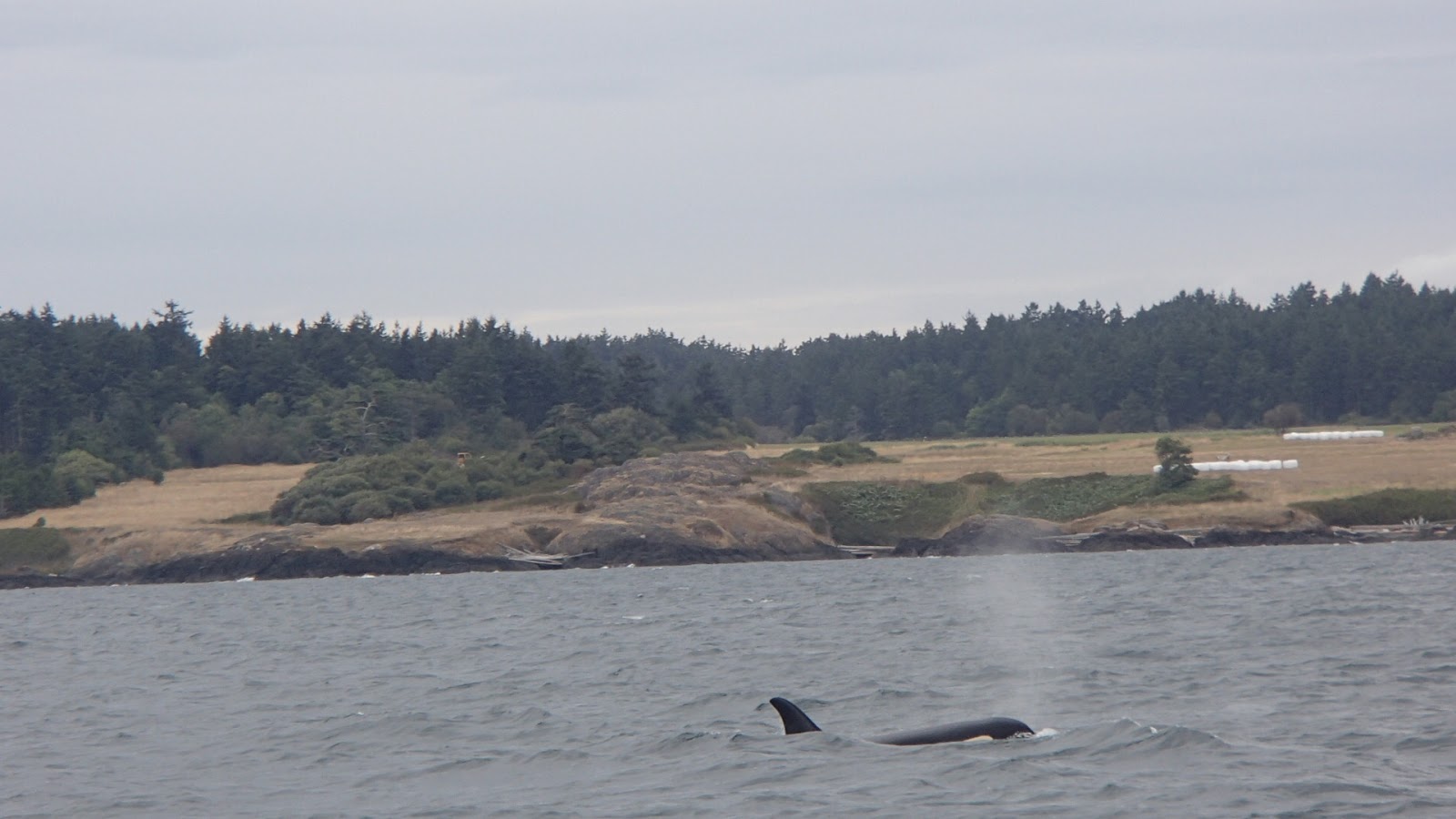
      And then we see the orcas!  Caroline, our eagle-eye whale-spotter and the primary advocate for taking this route, spots them first.  There follows much whooping and yelling from the crew; we sound like a bunch of loonies.  I turn Escape around and we zigzag for awhile.  It looked like a pod of about three whales.  Their dorsal fins would poke up, and every so often their entire body would broach the surface.  Cameras are clicking.  From our knowledge of the creatures gleamed yesterday at "Key Lime" Point, we know how to distinguish males from females. 

Orcas ho!
     We are not alone - boats seem to come out from EVERYWHERE.  Whale-watchers, sight-seers, other sailboats, you name it.  It seems they have some sort of network.  Eventually we conclude that that the whales and whale-watchers will do just fine without us, so I turn  Escape northward and we continue our trek up the coast.
Robert gives the captain a break
     The wind gets pretty breezy, and the waves get a little rough.  A couple of crew members get a bit queezy.   The sun never does come out, and it's cold as heck.  We even feel a couple of raindrops.  But no one is complaining.  I have the crew get the bimini ready to deploy, in case it starts raining and we need shelter.  Escape has a sort of poor-man's bimini (a canvas cover for the cockpit), not exactly state-of-the-art, and when deployed it blocks my view of the sails, so it's used only as a last resort.
      The wind continued to build, and now I am fighting serious "weather helm", where the boat wants to turn into the wind really bad.  Time to reef in the main.  (A "reef" is where you reduce the square footage of sail exposed to the wind.)  No one else on the crew had ever done a reef, but I talked them thru the procedure step-by-step.  It actually went quite smoothly.  And instantly, the excessive heeling stopped and Escape behaved MUCH better.  I tell you:  I am becoming quite the salty sailor at this monohull thing!
Lonely lighthouse
      And hey - how 'bout this crew!?  As recently as yesterday, they didn't even know what the traveler was (it's a beam-wise track onto which the mainsheet is attached), and now they not only can adjust the traveler, but they know how to reef!
Robert the "human whisker pole"
      A half-hour later the winds slacked off, and we go into a full-on downwind run.  Out comes the reef, and we are back to full sail.  Hmm, I wonder if we could ... Hey crew, put the jib over on the starboard side and keep the mainsail on the port side.  Set the traveler all the way to leeward.  It worked!  A wing-and-wing configuration - and without a whisker pole!  No one on the crew had ever seen this, and jaws were agape.  By golly, is there ANY sail trim option we have NOT done on this leg?!?  (Escape did indeed have a whisker-spinnaker pole, but deploying a pole is the sort of thing you must PRACTICE, and this was a rather green crew.)  But I did have Robert stand on the starboard deck, hold onto the shroud, and hold the jib out:  my "human whisker pole".
       The depth gauge starting acting funny.  It would just blink the word "LAST".  What the heck does that mean?  I tried re-booting it, everything.  We even pulled out the manual and tried to figure out what it was doing.  This is a critical navigational tool, and I absolutely could not anchor without it.  Later, it would be determined that it had exceeded its depth limit, as it started working again when we got into shallower water.  The water here in the Haro Strait was, like, over 1300 feet deep!  It seems like the gauge should show "Max depth exceeded" or "999" or something along those lines. 
Military ship in Haro Strait
     Speaking of depth, it was absolutely astounding how deep these waters were.  The water was NEVER less than a hundred feet deep unless we were a stone's throw from shore.  Depths way up in the hundreds of feet were very common. 
      Finally the long sail is over and we pull into Roche Harbor.  It, too, was very lovely, probably a bit more upscale than Friday Harbor.  The usual flotilla of kayaks and dinghies were everywhere.  Here, the lanes between the docks were a LOT wider than at Friday.  We get some diesel fuel, some more gasoline for the dinghy, and again top off the water tanks.  How the heck is it that we consume so darn much water?
     At the dinghy dock, Mitch and I see a dinghy approaching with two little old white-haired people aboard, a man and woman.  We walk up with plans to take their lines and assist them as they disembark.  But the next thing I know, the little old lady VAULTS out of her dinghy, in one graceful move, up onto the dock!  Ooooo-kay.
Hotel do Haro in Roche Harbor
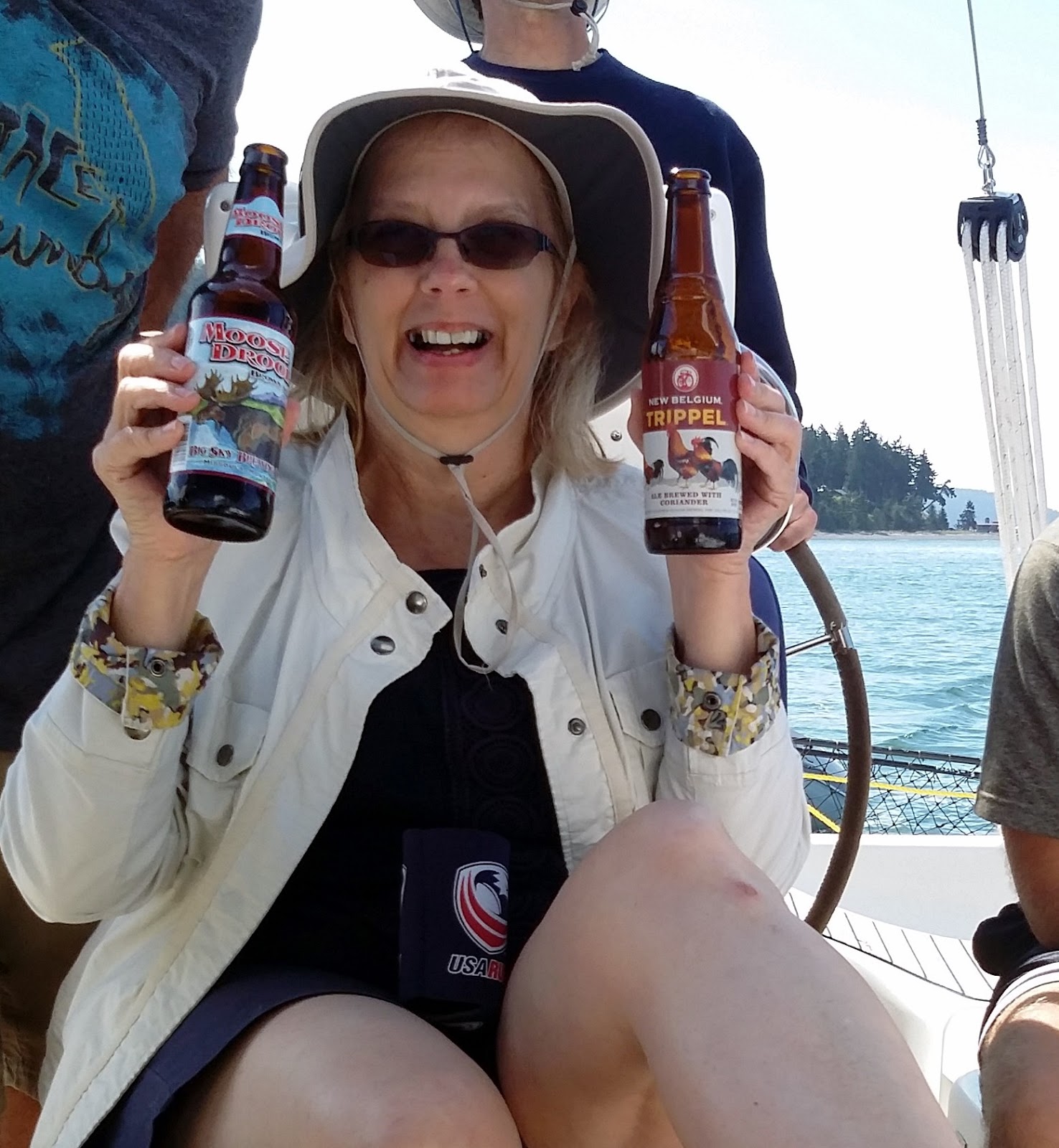
    We eat a quick lunch at a lovely waterside restaurant, grab a few provisions (mainly beer and ice), and we're off to Stuart Island, just a couple of miles north of Roche.
     Upon arrival at Stuart Island at about 7:00, we head into Reid Harbor.  There is only one word to describe Reid Harbor: paradise!  It's a long, narrow bay, maybe a mile long and a couple hundred yards wide.  It's surrounded by high hills and rocky cliffs, and there is a small beach at the end.  Lots of good wind protection. There are maybe a couple dozen boats here, at anchor or tied up to small docks hither and yonder.  We pick a spot and drop anchor.
Reid Harbor, from up on the hilltop
      A few words about anchoring:  In my sailing career, I have not done a great deal of anchoring, although I've read much about it.  Experienced sailors describe it as somewhat of an art.  (Capt. Fatty Goodlander, circumnavigator and prolific sailing author, has a book out called "Creative Anchoring.")  Tying up to a mooring ball, of course, is MUCH easier and more secure, assuming of course that the mooring itself is structurally sound, which is not an issue in these parts.  But in a somewhat crowded anchorage such as this, anchoring is a serious challenge.  You must get the boat to stop just where you want it, not too deep, not too shallow, not too close to other boats or the shoreline.  And you must consider TIDES (which you can pretty much ignore in the Gulf of Mexico and the Caribbean).  But I'm getting better.  Robert, my trusty "bow man" who had never before handled an anchor, is becoming rock solid!  And a lot of it is good communication between the bow man and the helmsman.

     Michelle and I hop into the kayaks and go exploring.  It turns out that all these small docks - there are three or four of them - are available to recreational boaters on a first-come first-served basis, courtesy of the Washington State Parks System.  The sign says there is a 3-day limit.  On the docks are picnic tables.  It looks like about six boats our size could tie up there.  It's late afternoon, and all the boaters are cooking supper - the air is filled with delicious aromas.  Everybody has a drink in hand.
      At sunset, this guy stands up on his foredeck and starts playing bagpipes!  A crowd gathers around, in lawn chairs, on the dock, on boats, dinghies, kayaks, everywhere.  He goes thru all the bagpipe classics.  A young girl, maybe 7 or 8 years old, is up the dock dancing the traditional Scottish thing.  Wow - what a happening place!
     Michelle and I go ashore and meet Craig and Michaela, and strike up a conversation about boating in these parts.   Later, Craig, in his dingy, finds Escape (via the two bright orange kayaks tied to the stern), and invites us all over for wine at his boat Ohana after supper.
     Ohana is a 56 ft luxurious motor yacht that they booked thru Anacortes Yacht Charters, just like us.  The thing is a veritable floating palace.  As we arrive via dinghies and kayaks, I am climbing out of the kayak onto Ohana's swim platform, but lose my balance and fall into the water.  What an entrance!
Crew of Ohana rescue's David
      Craig and Michaela and their crew rush to my assistance.  I'm Ok, but all my clothes are soaked.  Not to worry, Michaela says, we have a washer and dryer aboard and plenty of clothes and towels.  Anyway, we have a wonderful evening of wine, beer, and stories about sailing and whale-watching.  They give us a tour of the boat; clearly, no expense was spared in building this floating Taj Mahal.
      Afterwards, upon returning to Escape, this time it is Mitch who loses his balance while attempting to climb directly from the dinghy into a kayak.  Yes, that water is indeed cold.
       Long day.  Great day.

Thurs, Day #5. Roche Harbor (again), Sucia Island

Escape, circled, from up on the hilltop
       The morning is bright and glorious!  Michelle dons her wetsuit and does her sunrise swim.  Upon returning to the boat, she reports that a couple of seal pups swam over to check her out.
       Everyone else sort of sleeps in.  It's a lazy morning.  But once we're all up, we fix a huge "country-style" breakfast and chow down.  Yum!
      We have all eaten quite well on this trip.  Credit goes to our Galley Queens:  Joan, Michelle, and Caroline.  In particular, kudos go out to Caroline for taking control of the food logistics and ensuring we have the right provisions, in the right quantities.  It bears noting that, at the end of the week, all of the leftovers had been consumed. 
Michelle & Joan off to explore Stuart Island
      Each morning, we hang out wet laundry on the lifelines.  I know we probably look like trailer trash or something, especially with the underwear and socks out there, but hey, you do what you gotta do.
       Everyone loves the companionship and camaraderie;  but it is, shall we say, a bit crowded aboard with seven people.  Not much personal space.  Those of us who have lived aboard catamarans are spoiled big-time.  The area around the foot of the companionway steps practically needs a traffic light.  And climbing into and out of bed requires a bit of acrobatics, as there is hardly any headspace above in that so-called "cabin". 
Party of ocean kayaks in Reid Harbor
       Mitch has never had a cabin to himself, not on any of our sailing charters.  He ALWAYS has to sleep on the salon settee.  But, he's a trooper, and can sleep anywhere, anytime, regardless of the commotion all around.  He has also resumed his role of Dinghy Captain.  The boy truly has a touch with that sometimes-ornery 3 HP motor, and can always get 'er to start right up.
      We have great music aboard, too.  Everyone brought portable devices with all the classics, especially Jimmy Buffet, Zach Brown, and those guys.  Someone even brought "I'm On A Boat", a rather vulgar rap song (if you can really call rap "music"), filled with obscene profanities every other word.  Totally outrageous, yet somehow, hilarious in a goofy sort of way.
Robert, Michelle, and David, on the trail
       Today we explore Stuart Island by foot.  Hiking trails go up to the old schoolhouse, and on beyond to the old lighthouse.  Another trail leads up to a high, barren hilltop with a gorgeous panoramic view of the harbor.  Great photo-ops all around.  On the hike, we meet a 92-year-old gal who sails often with her son and his wife.  She told us that the couple recently completed a circumnavigation.
"Polar bears" Robert, Emily, & Caroline, before the jump
       That afternoon, Robert, Emily, and Caroline decided to go for a swim, polar bear style, to cool off after the long hike, or something like that.  I think it was one of those Double-Dog-Dare things, possibly even a Triple-Dog-Dare.  So they donned their swimsuits, counted to three, and jumped.  They didn't stay in the water long!  Caroline said it was "refreshing".
And after the jump.  Love that water heater!
       Once again, we are running low on water.  Damn.  How in the heck are we going thru so much water?  I suppose we need cut back our usage even further.  In the meantime, we have little choice but to fill up the tanks again, and the closest place is Roche Harbor.  Fortunately, it's not too much out of the way to our next stop at Sucia Island.
       But, I'm just a tad anxious here.  It will be mid-afternoon when we leave Reid Harbor, and we still need to get to Roche, fill up the water, and make it to Sucia before the sun sets.  I do NOT want to attempt to anchor in a dark, unfamiliar place, with boats and rocks and other hazards all around.  Hope everything goes smoothly and quickly at Roche.  At least we know where to go.
       When we arrive at the fuel and water dock at Roche, there is no space!  So we have to sit and "hover" near the dock, and wait.  And wait.  And wait.  These guys at the dock sure are taking their sweet time.  I see the sun getting lower in the sky.  More boats stack up behind me, waiting for space at that same blasted dock.  Minutes tick away.  This is not good.
      FINALLY, a boat leaves.  I flip Escape around and do a perfectly-executed maneuver to kiss the dock with my port side.  Captain Ron (a movie character played by Kurt Russell) would be envious!
Joan compares local brews
      A quick water fill-up, sewer pump-out, a bag of ice, and we're off!  My crew performs their assigned tasks with flawless perfection.  Also, we recognized one of the boats there at the dock - we had met them back on Stuart, with their two boat dogs.
       The wind is dead.  Dead as a doornail.  Zip.  Zilch.  Not a single riplet on the smooth-as-glass water surface.  Looks like it's gonna be engine-power all the way to Sucia, about 13 nautical miles.  I always feel like such a failure when I resort to the "iron genny".  You know, our sailing ancestors explored the globe without that noisy, vibration-inducing, fume-spewing mechanical contraption. 
        But, no one on the crew is complaining.  After our hair-raising jaunt up the Haro Strait yesterday, they are all perfectly content with a nice, gentle, flat, lazy stroll up the President Channel - as the sun sinks lower and lower.  Also, this gave the Galley Queens an opportunity to do most of the food prep for supper in advance. 
Mt. Baker, always a good landmark!
       As we clear the northwest corner of Orcas Island, good ole' Mt. Baker slides into view.  Mountains are always in view, of course - 360⁰ of picturesque majesty!  But Baker is truly a stand-out.
       Near Sucia Island, we pass another group of ocean kayaks.  These kayaks are extremely long, and hold two or three people, plus gear.  We see them out everywhere, even out in the open water between the islands.  I dunno - that much paddling seems like an awful lot of work.
       We pull into Echo Bay on Sucia Island just as the sun touches the horizon.  Anchor down.  Whew - just made it!
       Echo Bay is glorious!  Well heck, ALL the places we've visited are glorious, although each has its unique charms.  It's a bit larger than Reid Harbor, and Mt. Baker is visible to the east everywhere.  Sucia's unique characteristic is the five long, narrow "fingers" of land that run roughly east-and-west.  Some of them are technically islands, some are peninsulas.  We couldn't really see this feature approaching from the south like we did, but when viewed from the east (which we saw when we left the next day), we could clearly see that this is one weirdly-shaped island.
Sucia's five "fingers", visible from this offshore shot
      Sucia Island is our furthest point from civilization.  We are WAY out in the northern reaches of this archipelago.  Like everywhere else, there are lots of boats here.  And kayaks.  We are never alone.
Looking down a channel between "fingers"

      After the sun went down, the real show started.  Way out here, far from the lights of civilization, you get to see things you can't see elsewhere.   In the water, there was amazing bio-luminescence.  Any kind of disturbance would make the water sparkle.  The best way to see it was to kayak away from the boats and their sea of mast-top anchor lights.  Even the kayak's bow wake would glow!
Echo Bay at sunset